Online monitoring
Devices are monitored in real time from a computer or mobile phone. For this, there is no need to install special programs either on the organization’s server or on the work computer, it is enough to access the WEB interface through a browser using a login and password.
Determining the exact location according to GPS.
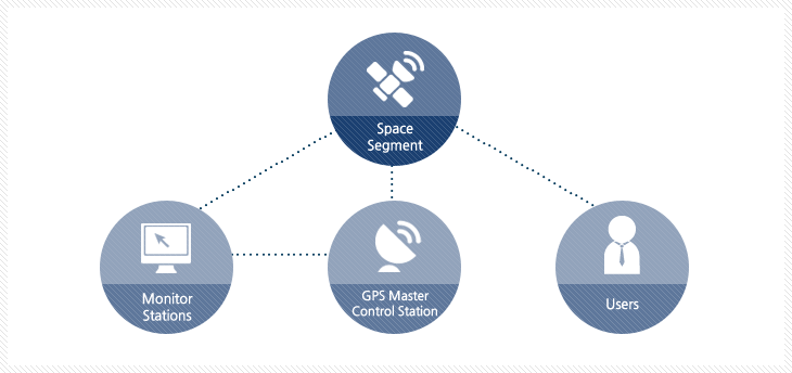
Satellite navigation signals provide the most accurate determination of location, speed and direction of movement. Current and accurate information allows for online monitoring of devices and detailed movement history.
Current information
In addition to traffic parameters, it is also possible to view various relevant information in real time mode, such as: sensor data, mileage, activity time, who is driving the car. The display of the above information can be adjusted according to your needs.
Detailed maps
Monitoring system GPS Control offers the largest selection of maps. All maps are licensed; You can use the maps without extra charge.
Detailed detailing before the building
The system offers 12 maps on which streets and satellite images are marked, which provides ideal cartographic coverage both in Georgia and anywhere in the world. Maps are switched with one click of the mouse. If the selected map does not provide the necessary detail, you will definitely find the desired information when choosing another map.
Geocoding
Smart Search automatically maps the address you’re looking for. If the information on the address is not complete, the system will offer several closest options.
The address of the location is also indicated in the alarms, messages and analytical reports, making it possible to easily determine where the event occurred, where the route started and where it ended. In addition to the address, all the above information is accompanied by exact geographical coordinates.
History of routes
The monitoring system keeps a detailed history of device movements for 6 months. At any time you can see the movement of the device on the map. It is also indicated here:
Start, stop and finish address, date and time;
Device data transfer address, date and time;
total duration and distance;
movement time, stop time, motorcycle hours;
average and maximum speed;
fuel consumption;
Alarms and notifications
GPS Control allows you to monitor a wide range of events through a flexible control system based on the location recorded by devices and the violation of pre-set conditions. The relevant conditions are determined by the user in advance, in terms of a specific device.
Our new alarm system consists of 15 alarm types, the number of which will increase in the future:
Digital IO
Arriving/departing from the object
Entering/exiting the zone
stop at the object
Parking in the zone
Speeding in the zone
Parking the car
Speeding
Standing with the engine running
Driving with the engine off
button alarm
temperature alarm
Vehicle movement
Parking at the object
Parking in the zone
analytical data
The GPS Control monitoring system allows to fully analyze the information on the use of the car park and cargo transportation, to evaluate the efficiency of the staff’s work. For this, the monitoring system processes the telemetry and navigation information received from the trackers and displays it in the form of various types of reports and graphic diagrams.
reports
According to the main areas of use, reports are divided into functional groups, which makes it easier to find the desired information. The following reports are most often used in daily activities:
Routes – aggregated data by devices or days. The report shows operating time as well as vehicle operating data such as driving time, engine hours, distance, fuel consumption and speed. The report can be displayed according to predefined working periods, the use of additional filters allows to see the necessary information according to specific days and geozones.
Stops – summarized and detailed information about the routes with the date, time, duration and place of the stop, as well as the fuel consumption. The reports of the first start and stopping at the object are separated.
Alarms – a report of alarms registered in the system, both detailed and summarized.
Services – a report of the services registered in the system with an indication of the execution status.
Fuel report – comparison of the fuel limit specified for the device and the amount of fuel actually consumed.
Review
In addition to reports, you can see the state of the fleet from different angles through a clear graphic image, for example, the vehicles on which


